Trail # 1:
The Baum*Blick*Bliss Radweg
Radweg: designated bicycle trail – runners & walkers welcome!
PLEASURES OF THE HOME LOOP
Don’t you have a basic loop for biking/walking/running starting from your house? Bikers/walkers/runners often have a regular route -or several – for those routine work-days evenings and at-home weekends.
Our home routes become a meditation in repetition and we know each time ’round the loop is a unique and varying experience. The physical landscape of our routine local route may not change much, but the cycles of seasons, daylight and dark, weather & temperature – change with each outing, change without cease. These variables add variety, keep it interesting. First the home route becomes a habit and, over the years, a beloved ritual.
We find comfort and rejuvenation in this balance of sameness / change. Another variables: our state of mind, our mood, our body. We stomp during angry walks; then, on that delicious late-spring evening – you know the one – we walk with joy. The comfort of habit and repetition, the change, the sameness, becomes a beloved, meaningful facet of a life well-lived.
PIONEERING THE BAUM*BLICK*BLISS STAR ROUTE
During the year I lived in Baumholder, I gradually pieced together a good loop starting at my place and looping out and back in an hour or a bit longer. The route traverses the hills around Baumholder, which is situated near some of the highest hills and ridges in the Nordpfalz Bergland, literally the “North Palatinate Upland Forest” Let’s call it the Pfalz Hill Country. (The German word for Palatinate is Pfalz. Pfalz is pronounced ‘fowls.’)
With each ride around my home loop, my enjoyment grew, the quiet surroundings relaxed my mind, worked my body, and recharged my emotional batteries. Starting in fallow winter, I watched the spring burst forth with exuberant wildflowers and bright yellow fields of ‘raapstaat,’ summer’s fertility, and autumn’s leaves painting a polychromatic paean to change
I call this trail Baum*Blick*Bliss. Climbs are rewarded with blicks – viewpoints over the hills and valleys. The variety and landscape of this ride will offer up glimpses or gulps of happy moments and bits of bliss – ergo: Baum*Blick*Bliss. The hills aren’t long, but this is a good workout; a hearty mix of paved roads, gravel roads – and, just for giggles, some smile-enducing single track and downhill grass-trail glory.
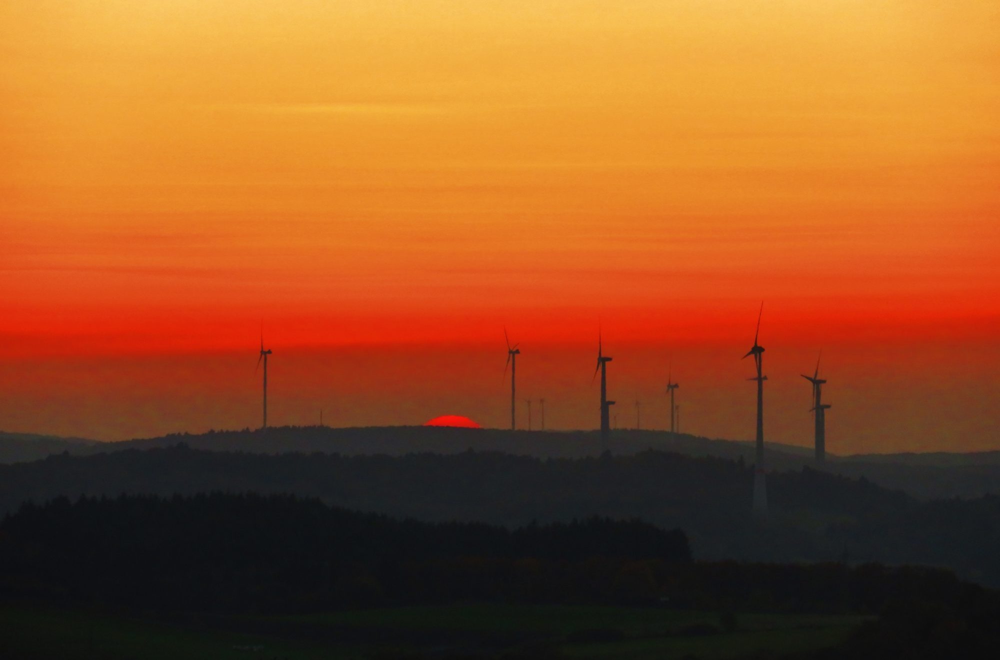
The route has ample surprises – and a money-shot blick/view looking west and southwest out, above Baumholder town and the distant Nahe River Valley. The blick, called Engelmichel, is equipped with a comfortable lounge-chair-for-two park bench – and a daily sunset cloudance over the horizon – the high, dark ridge of the ancient forest, the Hunsrűck Hochwald.
TRAIL NOTES
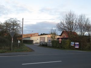
- Finding the Start of this trail is not easy. It begins on a nondescript intersection on the east edge of Baumholder’s Ringstraße, ring road. Print off and consult the map, then, starting from the intersection with the ‘Kik’ store, follow the Ringstraße (Ring Road) uphill toward the top of town (away from the grocery stores Netto and Edeka). Go about 500m/1/3 mile uphill (walk or ride the good bike paths along the Ringstraße). Look for a parking lot full of buses on the right side.
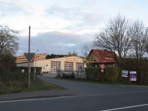
This nondescript intersection is the START of the route. A modest portal – treasures inside! - Facing the sign for this business, “Auto Westrich,” the Start is at the beginning of the paved road to the left of the sign and fence. The first section of trail follows another small paved road which drops downhill on the left.
- The BaumBlickBliss Radweg is a ‘star route,’ meaning the trail goes out into the country, then backtracks, then heads back out on another road, then back – and so on. This makes it easy to adjust your route due to conditions and desired distance/time.
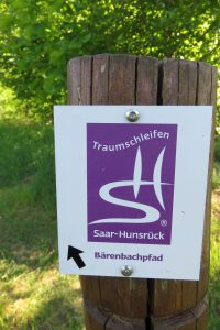
- About half of this trail is follows the Barenbachpfad, a 14km/8-mile designated walking/running/biking loop trail which begins and ends at the Baumholder Lake Park parking lot. (The Barenbachpfad hike will be covered in an upcoming post.)
To park near the center of the route: From Baumholder zentrum (downtown), drive to the intersection with the ‘Kik’ store, drive uphill on the highway (L-176) toward Kusel and Burg Lichtenberg. After about 1km/1/2 mile, take the first road to the left; it is marked ‘Gärtel’ with a big wooden arrow sign. Park in the lot near this intersection and follow sections of the trail from there. Another option is to continue 1 km along this narrow, paved road to the parking lot at the entrance to the ‘Gärtel’ nature education area. Bikes and walking only beyond the gate. This area is part of the Waldhaus Loop, point #8 on the map.
- If you follow this trail and enjoy it, please leave a comment – happy to hear from you! ~ Dr. Mike
TRAIL DESCRIPTION
- Time: Biking: ≈ 1 hour / Running ≈ 1:15 – 1:30 hours / Walking ≈ 2 – 3 hours
- Distance: approximately 9 km / 6 miles
- Surface: 2/3 paved, sections of gravel, single-track dirt and grass
- Equipment: Mountain bike or hybrid bike, helmet, water, raingear (this is Baumholder!), camera/phone, the attached map!
- The route can be followed in either direction; the map indicates a clockwise route.
- The Start of the route is at the intersection of Ringstraße and Erzweilerstraße (this is Germany!) and the End is at the Baumholder Bad (lake) near the NETTO grocery and the nearby traffic circle. The Start & End are easily accessed through the Artillery Gate or the Main Gate of USAG Rheinland-Pfalz-Baumholder.
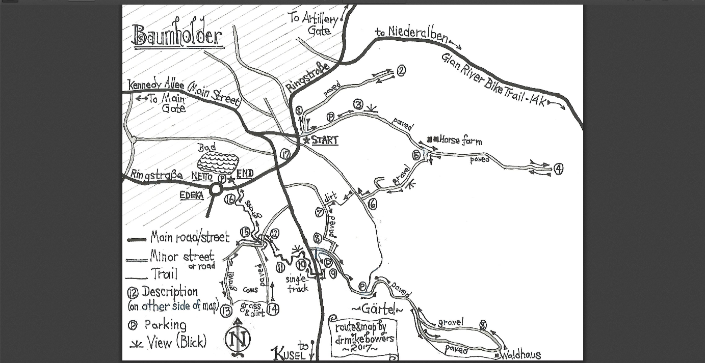
Printable PDF of map: Baum.Blick.Bliss.map.10.17.
SEE CORRESPONDING NUMBERS ON THE MAP
- The Start is on a minor paved road which intersects with the eastern side of the Baumholder Ringstraße. Although there is no street-sign, the street opposite the Start is Erzweilerstraße. The Start is to the left facing the business sign announcing “Auto Westrich”; look for their big lot of tour buses.
The nondescript START. 2. From the Start, take the one-lane paved road which drops downhill to the left among the trees. Eventually the road levels off; go 2/3 km to the end of the pavement. The first out-and-back road leaves the town far behind. Enjoy the view, then turn around and retrace your route back to the Start intersection.
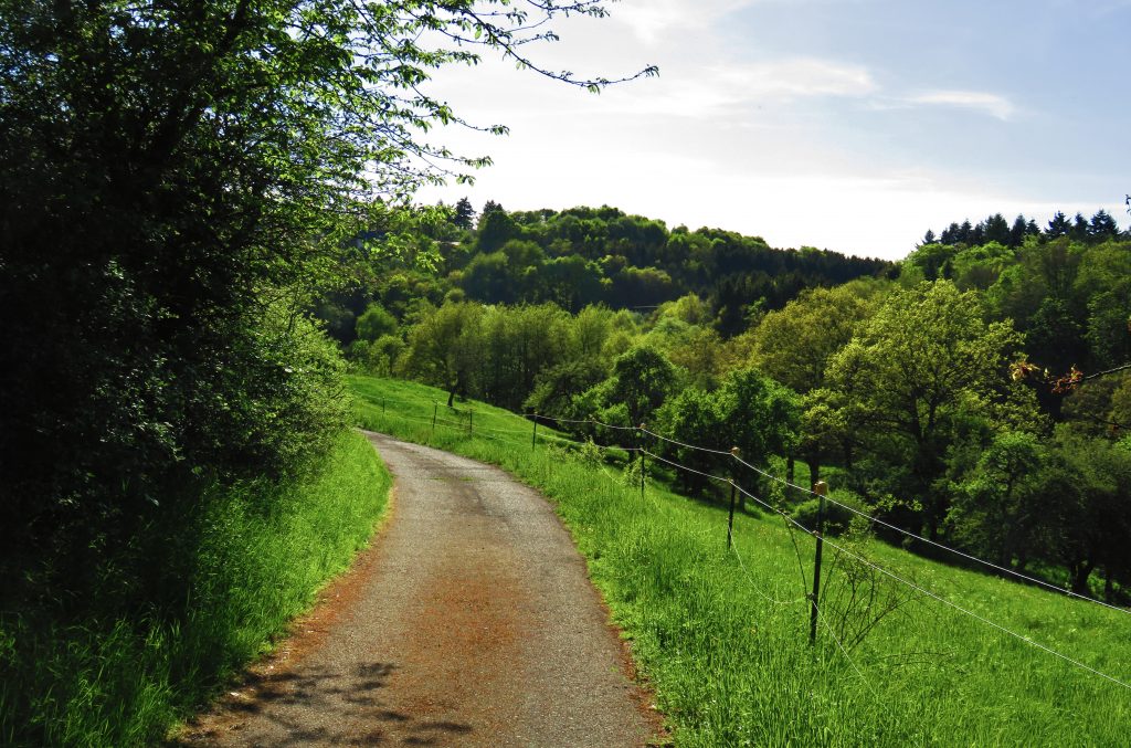
The countryside begins at the edge of town. 3. As you near the Start intersection, take the uphill 2-lane paved road to the left. Follow this road gradually uphill. (A short way up this road from the Start is a convenient roadside parking place.) Enjoy the nice view/blick of the valley to the left as you feel the burn during a good, steady climb. Continue gradually uphill on the paved road past a horse farm (on the left) and continue following the paved road (which becomes two parallel strips of pavement with grass in-between) to the end of the pavement.
4. The paved road ends at a T-intersection with gates to the left and right. Take a break, then turn around and retrace the road you rode in on gradually downhill to the Horse Farm (which will now be on your right, duh).
5. As you approach the Horse farm, watch for the gravel road leading uphill on your left. Take the gravel road uphill – this gravel section is one of the toughest climbs! – keeping right at the first intersection. Enjoy the view/blick as you top the hill. (Here the route begins to follow the ‘Barenbachpfad’ * signed hiking trail (for most of the remainder of the route.) Take a left when you reach the pavement. Coast downhill to a T-intersection with a paved one-lane road.
6. Turn right on the paved road and travel about 20 ft./7 m, then turn left onto the signed single-track grass-covered trail. Gain some speed and climb the eroded dirt trail up a short – but steep – section. (This is the crux of the route! Can you climb it without walking your bike?) Follow the rough dirt trail around the edge of a field until you reach a paved one-lane road.This short-but-steep section is the crux, the most section of the trail.
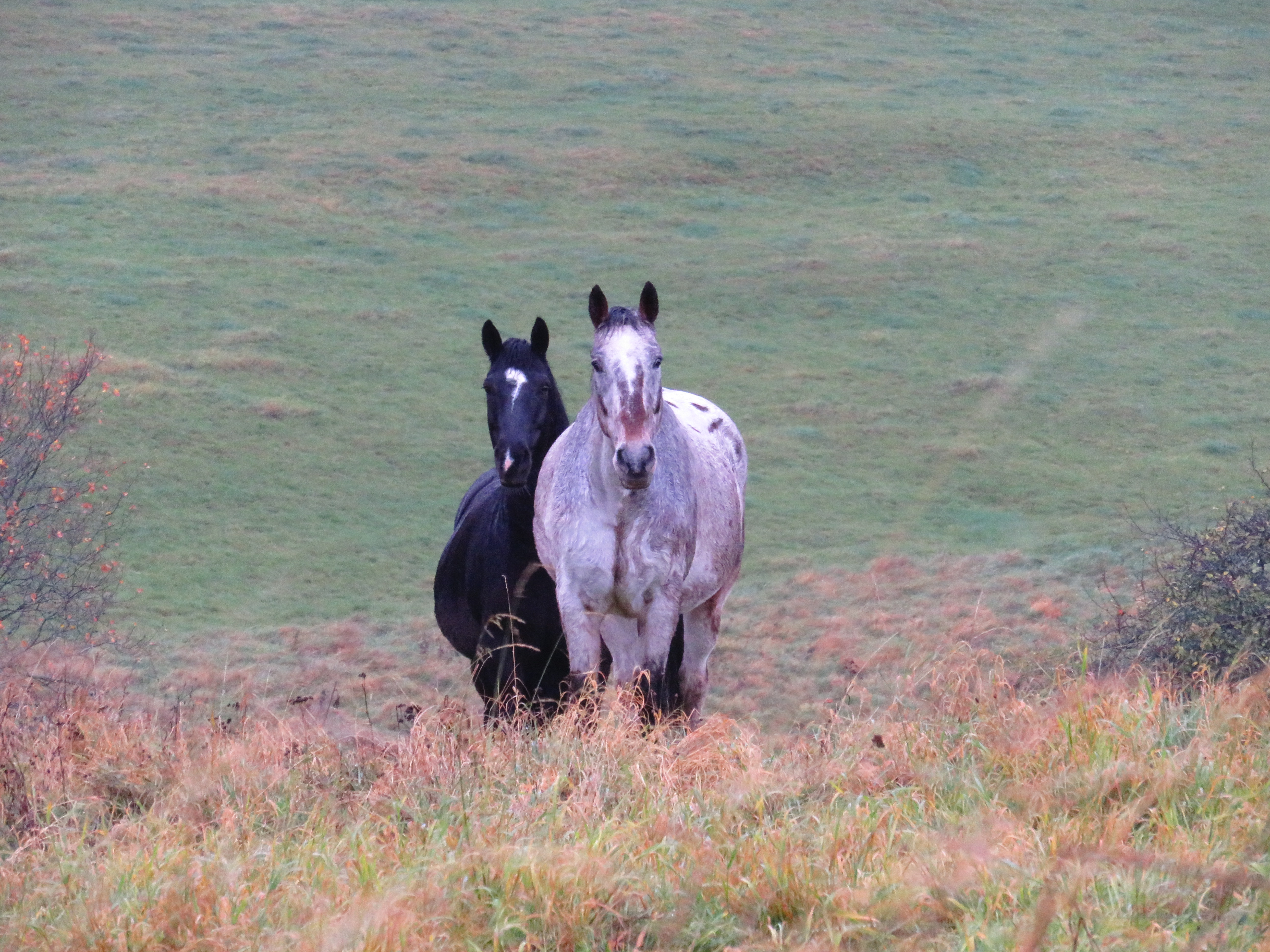
7. Turn left onto the paved one-lane road and climb uphill for a stretch, onto a gravel road which levels out and rolls past a meadow with 2 horses usually present.
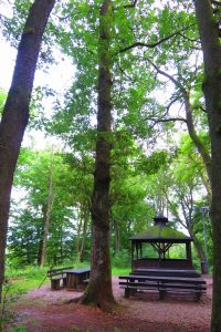
8. Waldhaus Loop: Follow the road around the horse pasture to where it forms a T-intersection with a paved one-lane road. Turn left and follow the paved road downhill through the woods, over a creek, through a parking lot (for the Gärtel nature education area). Go around a closed gate keep straight on the pavement (no cars past the gate). Follow the paved road another 1.5 km to a picnic house, gazebo and grilling-pit called Waldhaus. Here the road curves left and turns into gravel. Follow this loop back to the paved road, then retrace your route back to point #9. (To shorten the route, consider skipping this loop to Waldhaus; skip to point #9.)
9. This area is a dirt parking lot (just off the highway – L-176 -which heads south from Baumholder to Kusel, note the wooden ‘Gärtel’ sign facing the highway). Cross the parking lot and follow the signed ‘Barenbachpfad’* trail into the woods parallel to and east of the highway on pleasant single-track through a Dr. Seuss forest.
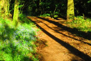
Soon the trail crosses the highway (be careful crossing – high speed traffic!) and then parallels the west side of the road on fun single-track through a mossy gnome-home forest, then…
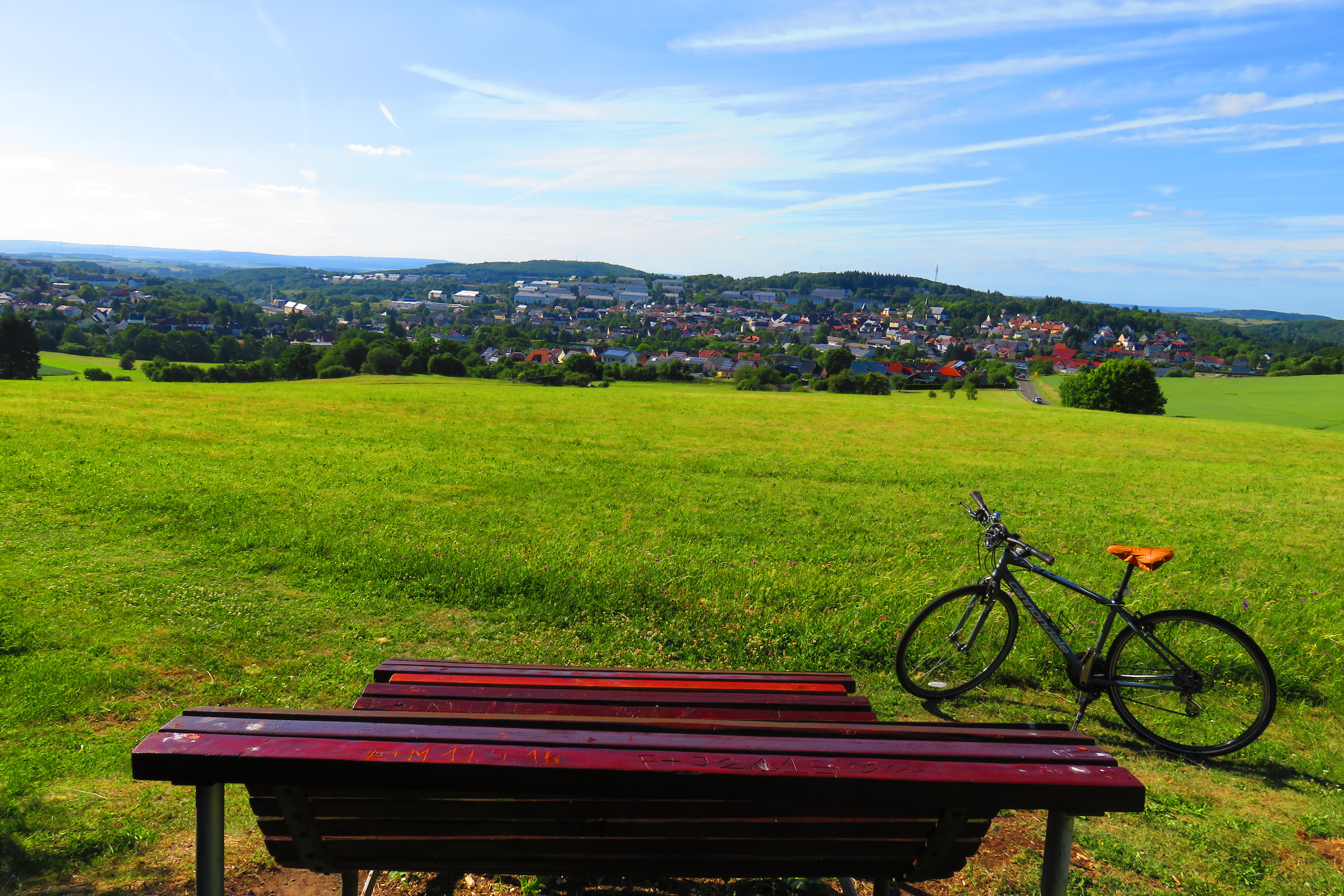
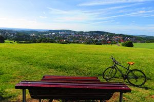
10. …the trail abruptly bursts out of the forest – a great viewpoint/blick of Baumholder town is revealed. This is a great place for a break, hydration & snack; enjoy the 2-person lounge-chair park bench! The view to the west is quite pleasant at sunset.
11. From the view/blick, the trail descends the hillside meadow beside a zigzag electric fence at the edge of a broad meadow on a trail of grass. (Be sure to notice the variety of wildflowers during spring and summer.) (Very slick when wet!)
12. When the grass trail meets the pavement, turn left and follow the one-lane paved road uphill to a fork, take the gravel road to the right. Climb gradually through the woods and meadows until you reach the first dirt road on the left.
13. Turn left on the dirt road – or just before the road to cut across the grass for fun!
14. Turn left at the next partly-paved one-lane road at the corner of the cow meadow – and kick back & enjoy gravity. Feel the exhilaration of your well-earned coasting cruise to the End !
15. Roll down the road until you see the Barenbachpfad* trailhead turn left toward Baumholder town (near where you started the loop you just rode). This part of the trail passes one of the many seep springs which feed the
16. Baumholder Bad (a spring-fed lake). Lush pasturelands just beyond the edge of town – quintessentially German! Carefully cross the busy Ringstraße and End at the Baumholder Bad.
*Barenbachpfad = Baren: Bear / bach: creek / pfad: path