“But why think about that when all the golden lands ahead of you and all kinds of unforeseen events wait lurking to surprise you and make you glad you’re alive to see?” ~ Jack Kerouac, On the Road
Note: To see the a gallery of photos in this post in a full-screen size slideshow, follow this link: https://photos.app.goo.gl/xBu4O0uM1NyQF3Pm1
Zwillingbäume is a wondrous realm – and where our bicycling tours doth begin.
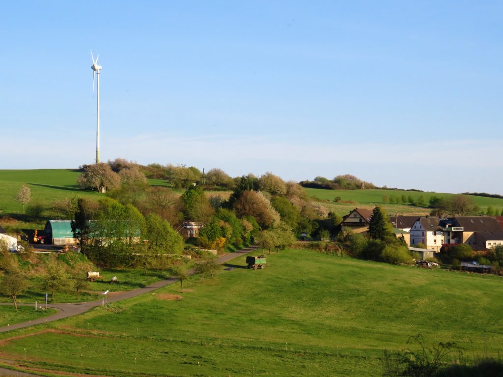
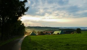
A few kilometers south of Baumholder – hidden in plain sight between two busy highways to the autobahn – the seven-house farming village of Eschelbacherhof sits at the center of an idyllic realm for bicycling and walking.
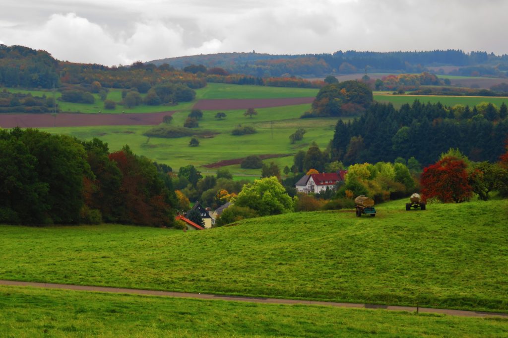
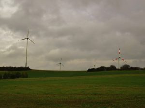
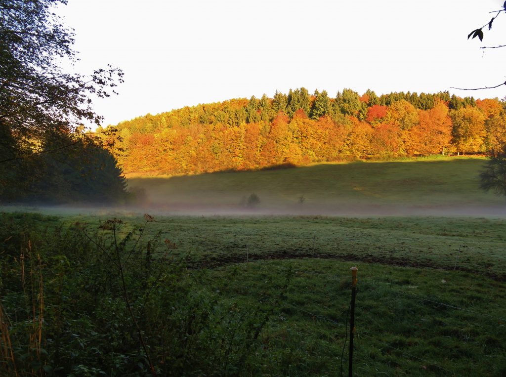
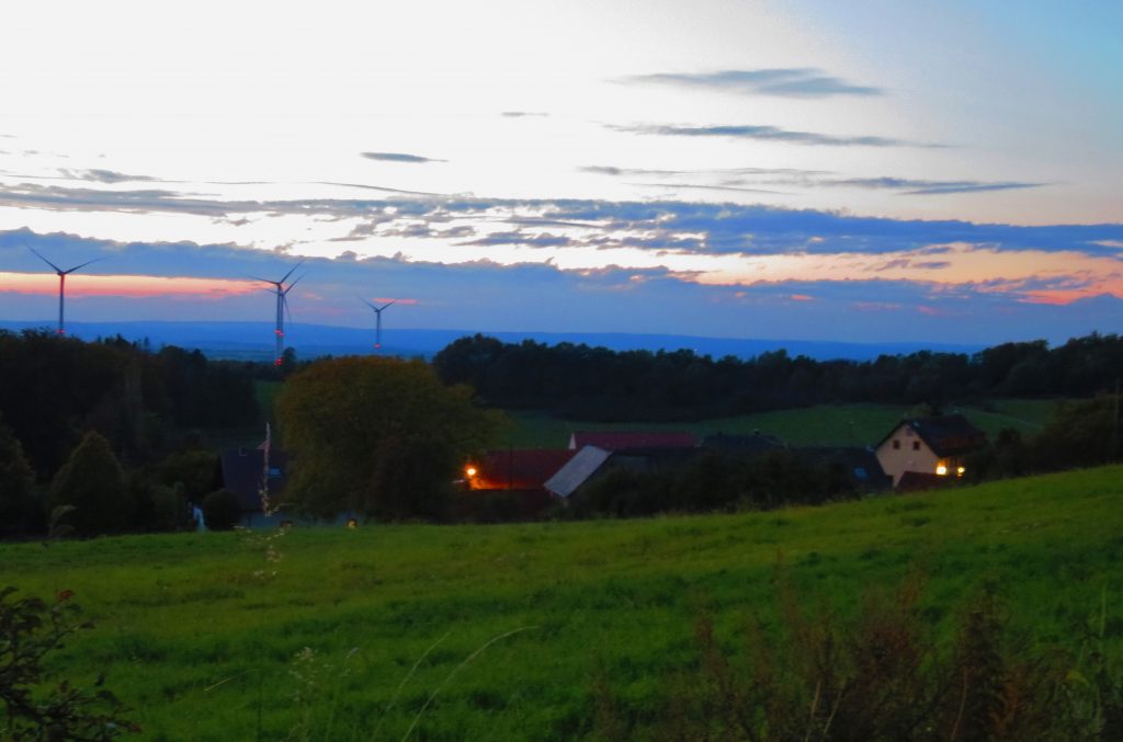
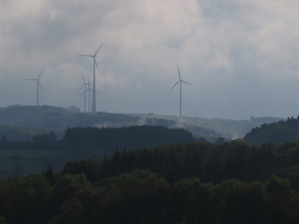
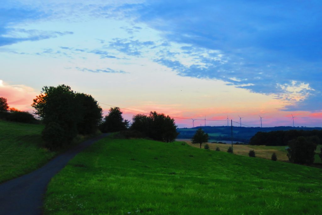
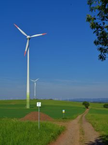
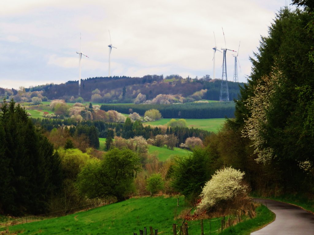
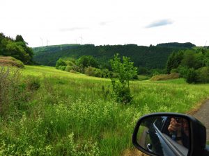
Just up the hill from Eschelbacherhof is ‘Zwillingbäume,’ a crossing of the three designated bicycling trails near Baumholder – and a delightful 360-degree view of the bergland! Zwillingbäume is near the top of a broad, grass-covered hill – a hochmoor. Green and serene landscape is in view at all compass points –hayfields and crop-fields stretch outward over the grassy rolling hills, past the silently spinning wind turbines and downslope to the steep, dark forests.
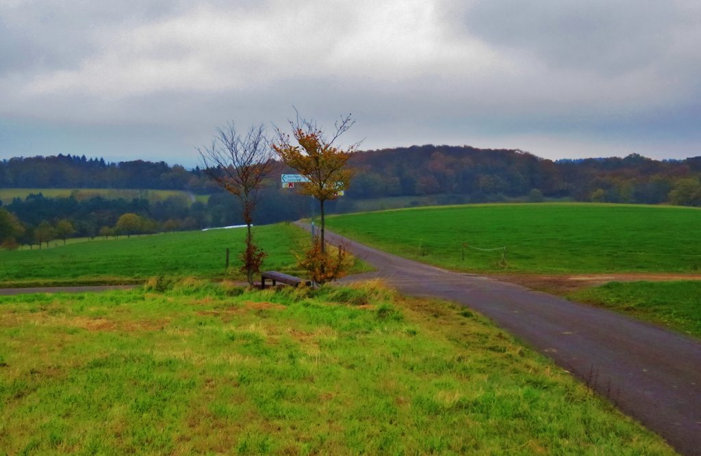
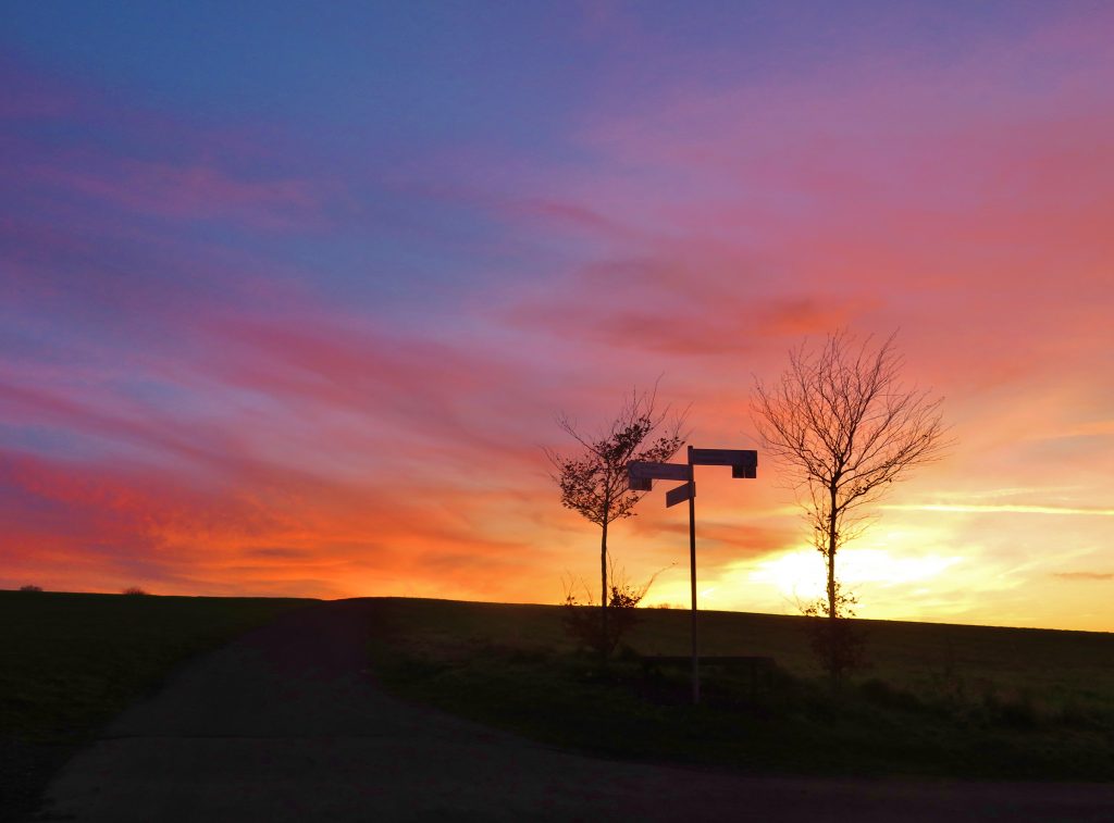
Zwillingbäume means ‘twin trees.’ A wooden park bench and two wrist-sized trees mark the spot. (There is parking here for one or two cars.) On this broad moor, the twin trees are the only trees for a kilometer in any direction. Hay meadows of cropped grasses – with scattered patches of woods – cover the nearby hills.
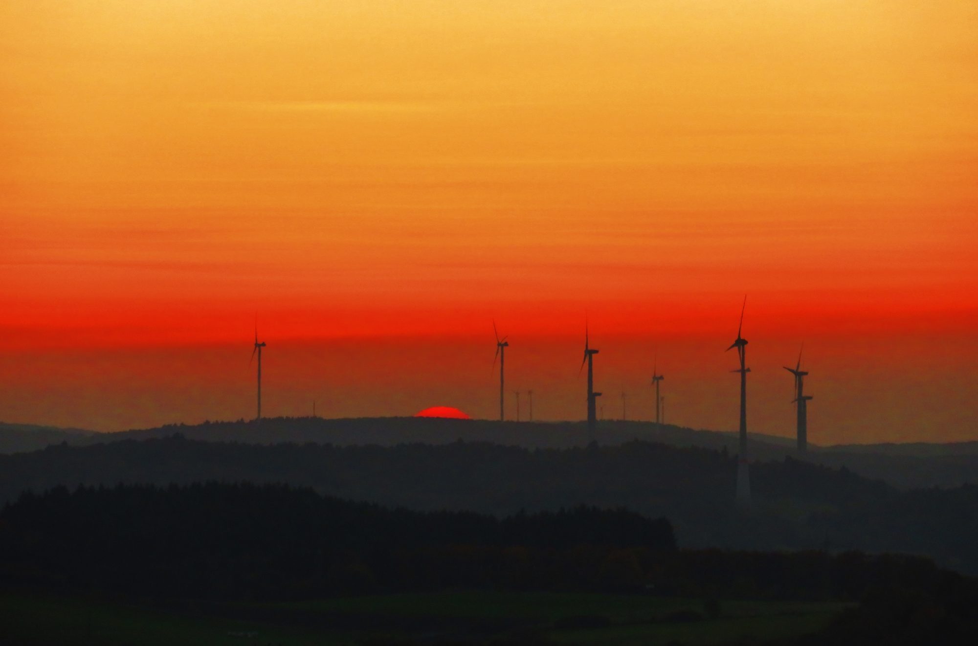
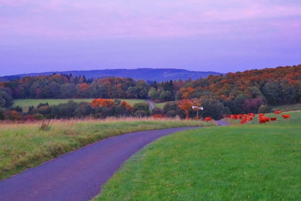
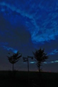
Starting from Zwillingbäume, walk southeast for ten minutes up a grass expanse to the summit of a hotchmoor hill called ‘Huf,’ a perfect spot to watch the sunset over the Nahe River Valley. The ridgeline of the ancient forest of the Hunsrűck Hochwald forms the northwestern horizon. As the sun nears the horizon on partly- cloudy afternoons, clouds beings and sunlight present a polychromatic sculpture and lightwave show! The four windmills that I call ‘The Family’ spin benevolently above.
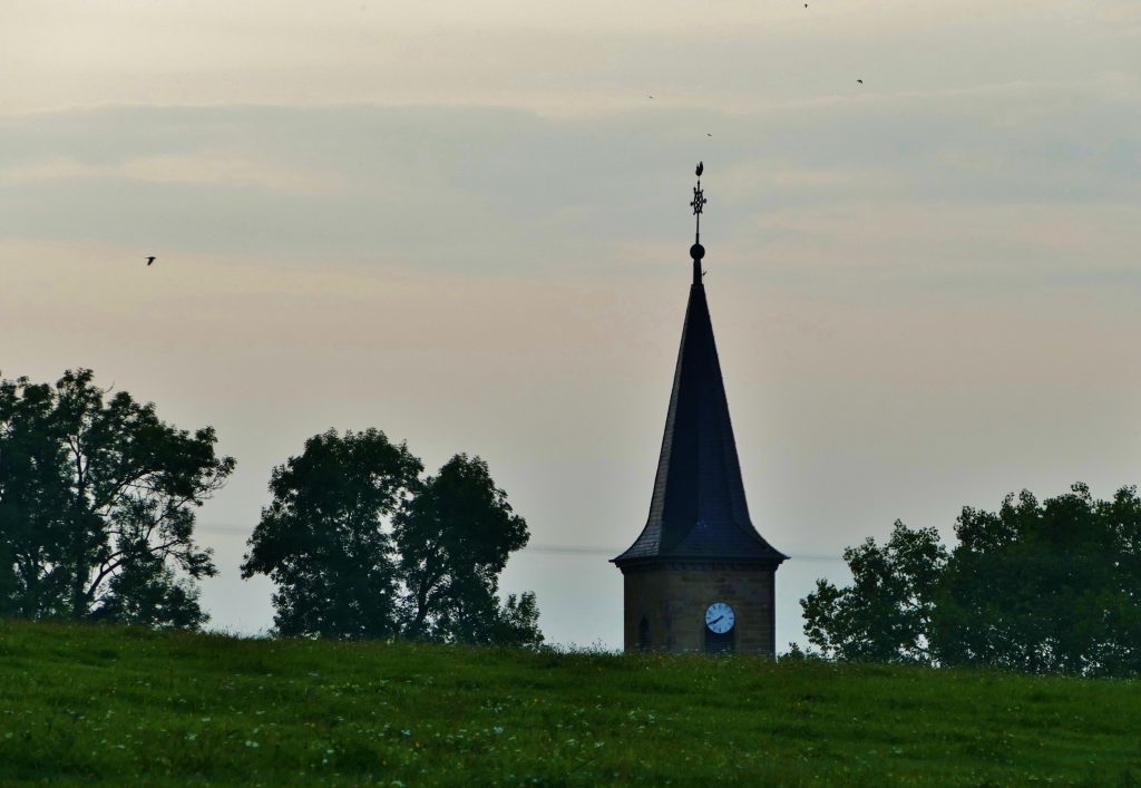
Just over the hilltop to the west is the hamlet of Eschelbacherhof, a working farm village with about 7 houses, founded in 1769.
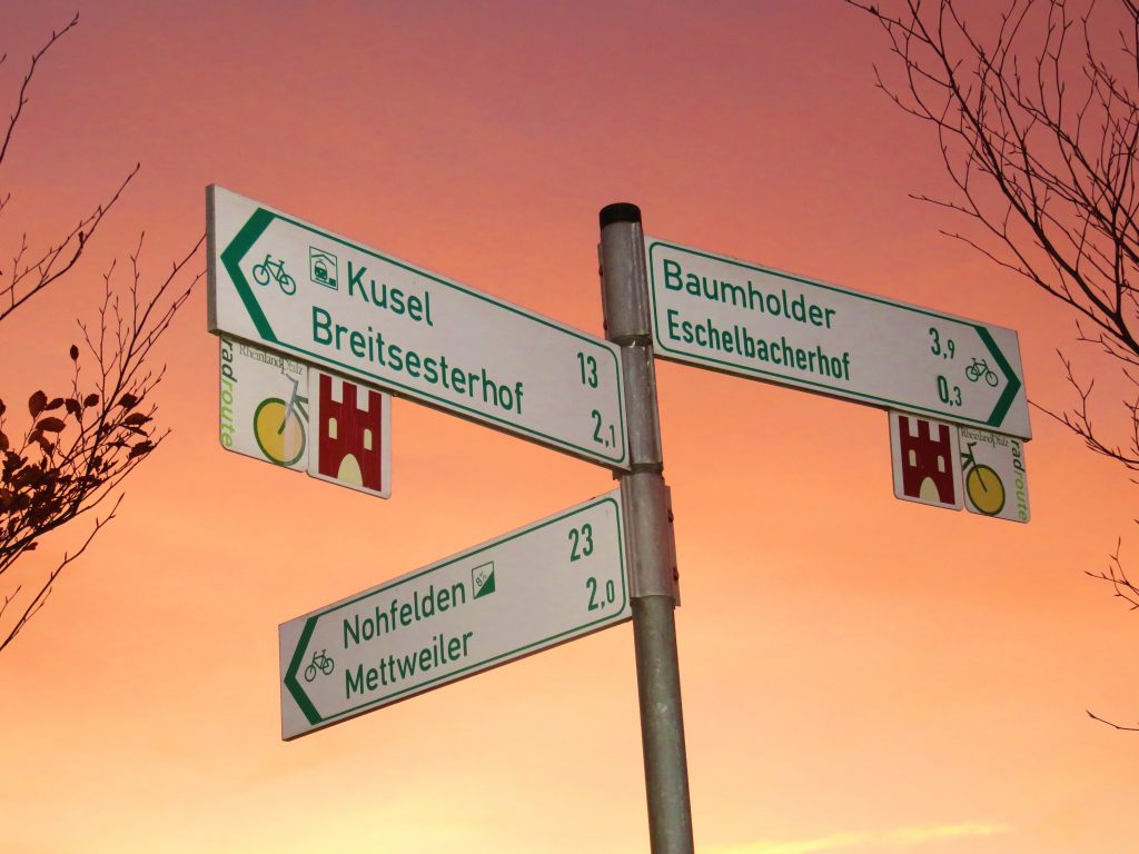
Zwillingbäume sits at the confluence of three radwege – designated bicycling trails: The 72k Rheinland-Pfalz Radweg, the 28k Bergen-Radweg and the 30k Seeradweg. (See upcoming posts on the Rheinland-Pfalz Radweg, the Bergen-Radweg and the Seeradweg designated rides.) From Zwillingbäume , great biking/walking roads, paved and dirt, head out in all directions.
This passel of trails will be described below, in the Trail Description.
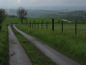
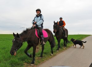
Rides in the bergland usually begin in a village, then head up through the forest, over the moorlands, and down to the next village. The standardized bicycling signs indicate the distance to and direction of the next village. Most rides are easy to navigate – simply follow the signs from village to village.
Now get out there on the hochmoor! You’ll see hawks, hares, deer and foxes – and cows, sheep, goats and horses. This green world – with clouds above – will offer calm. The light of evening will offer hope. You will soon be smiling.
The middle of nowhere turns out to be the center of here and now.
The spirit is strong, and the flesh is Zwilling…
ROUTE SPECS
Trail name: Trail #2: Zwillingbäume routes 2.1 – 2.7
Location: 3k south of Baumholder, Rheinland-Pfalz, Germany
Length: unlimited length options. The area features 3 designated bicycling trails heading off in six directions, plus dozens of paved and gravel country roads begging for exploration.
Challenges: Climbing up-hills / Rewards: Cruisin’ coasting down-hills!
Route-finding: Easy
Highlights: historic farming villages, wohnstallhäusen – house/barns, die Blicke – scenic views
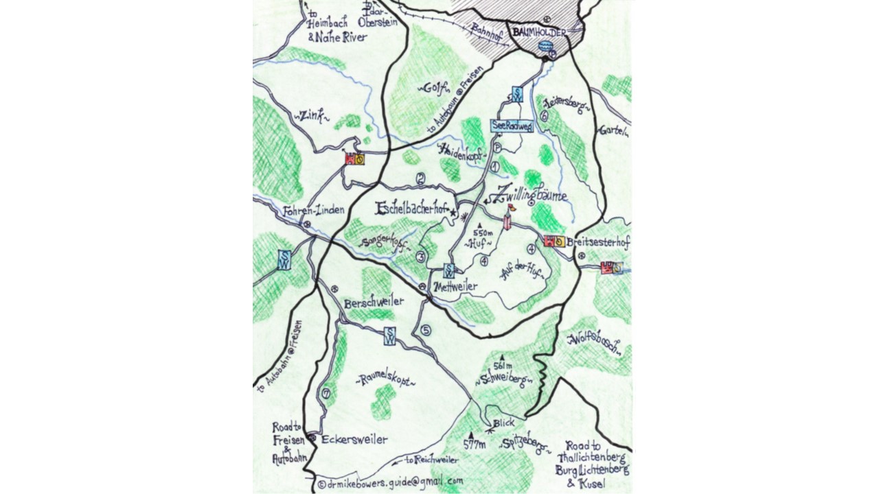
Click here to open the full-size printable PDF map for TRAIL#2.1.-2.7.:
Map Legend for Zwillingbäume:
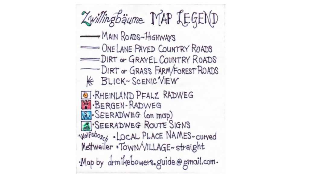
Click here to open the full-size printable PDF of the Zwillingäume MAP LEGEND:
TRAILS DESCRIPTIONS
Suggestion: Open or print the map before reading the trail descriptions.
See circled numbers on the map which correspond to the descriptions of the seven suggested trails.
Trail #2.1. Baumholder to Eschelbacherhof & Zwillingbäume
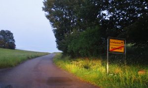
To find Zwillingbäume, start in Baumholder at the small traffic circle near the Bad/Lake Park on the Ringstraße, near the Netto grocery. From the traffic circle, head in the direction opposite the bad/lake. Follow the green ‘bike and arrow’ signs gradually uphill – through 1k of Germany-style suburbs to the edge of town.
As is typical of German villages, the town ends suddenly, and the beautiful pastoral countryside welcomes us. My suggestion is to drive to the edge of town, park and ride or walk the 2k to Eschelbacherhof, Zwillingbäume – and beyond!
The one-lane paved road curves through forest with glimpses of meadows, drops into the creekbed of Eschelbach and then climbs toward the hamlet of Eschelbacherhof.
The road reaches to a ‘T’ intersection. To the right, the Rheinland-Pfalz Radweg and the Bergen-Radweg head west toward the Nahe River (see Ride 2.2., below). To the left is the hamlet of Eschelbacherhof. ‘Hof’ means ‘farmstead’ and is usually a group of houses and outbuildings forming one or several farms.
Amazingly, this tiny hamlet features a ‘landschaftsgaushaus,’ a country inn – restaurant and tavern, Landgasthof Zur Scheune. (A great stop for beer or eis while riding. Just saying.) The road through the cluster of farmhouses is so narrow and intimate – one is literally in the hof (barnyard)!
www.landgasthof-zur-scheune-eschelbacherhof.de
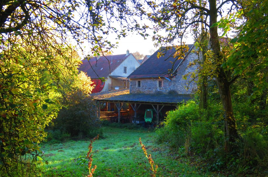
At the edge of the village, the road/trail takes a sharp turn and climbs to the hilltop above the town. Follow the road around the sharp left turn near the gaushaus and climb up – among the barns and machinery of a working farm – to the 4-way intersection of country roads I call Zwillingbäume . Form here, head out in any direction and explore the fine rides/walks outlined below – or discover your own!
Trail #2.2. Zink
This out-and-back route begins at Zwillingbäume and heads west along the overlapping Rheinland-Pfalz Radweg and the Bergen-Radweg. (Both will be featured in future blog posts.) The routes are well signed and continue any distance desired. The trail heads west-northwest through alternating forest and moor. The trail crosses the main highway from Baumholder to Freisen, then continues into an area I call ‘Zink,’ across the farmstead Zinkweilerhof.
The well-signed bicycle trail continues mostly downhill through Zinkweilerhof farm fields and meadows, eventually reaching the town of Heimbach on the Heimbach River, a tributary of the nearby Nahe River. (Note: don’t miss the great bäckerei in Heimbach). From Heimbach, the trail climbs a long, steep climb up to – then over – the moorlands, eventually descending to the Nahe River farther downsteam. (This route will be covered in detail in a later post on the Bergen-Radweg.)
Trail #2.3. Eschelbacherhof to Mettweiler Forest Road Loop – West
One of my favorites, this route traverses a deep forest on an overgrown dirt and grass road between Eschelbacherhof and Mettweiler.
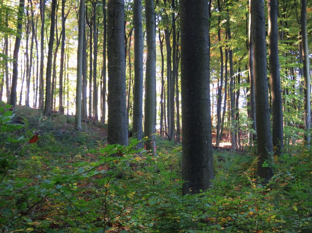
This loop trail begins in Eschelbacherhof. At the west edge of town an unpaved road heads south into the forest. The road curves along the traverse of a ridge and drops down into the valley of the Hirschbach and the village of Mettweiler.
Soon after entering Mettweiler, watch for a road to the left which heads back up the hill to Eschelbacherhof – your starting point, on a paved road.
Trail #2.4. Zwillingbäume to Mettweiler Forest Road Loop – East
This loop ride begins at Zwillingbäume and heads southeast on the gravel road. This section of road is one of the flattest rides in the whole area! After about .5k, the road enters the forest. This section is part of the Rheinland-Pfalz Radweg and the Bergen-Radweg (which eventually leads to Berg Lichtenberg in Kusel.)
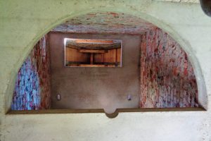
After another kilometer, along the side of the forest road sits an surprising sight – A 12-meter tall miniature castle tower! The tower features a sloping roof and Rapunzel-type window. The doorway is open. Inside, looking up, we see two concrete floors creating two small stacked rooms. The half-circle cutouts in the concrete floors suggest it was designed for a missing spiral staircase. I was baffled by this structure until I met a group of women hikers nearby. They explained that the tower was originally a relay station for rural electrification, now abandoned. A local man was working to convert it into a castle tower folly for the enjoyment of volksmarchers passing by. Sadly, the man died before completing his quixotic project.
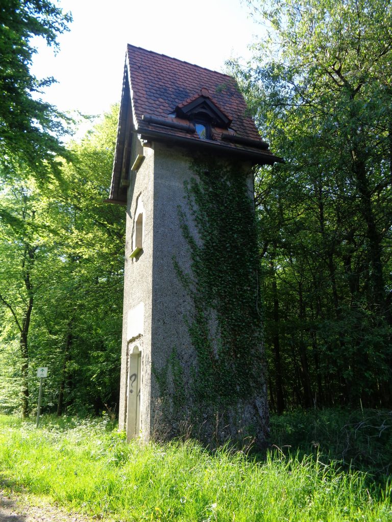
Continue straight – east – on the road. Watch for the next forest road to the right and take it. The road eventually loops around and down to Mettweiler. In Mettweiler, follow the paved road back uphill toward Eschelbacherhof. Ascending the road, watch for where the main paved road makes a big switchback to the left. Instead of cutting left and continuing uphill at the hairpin turn, take the road to the right, which is flat. There is a sign nearby which announces the road as ‘Welsch Allee.’ This road leads back to Rapunzel’s Tower. At the tower, turn left and ride the flats back to Zwillingbäume.
Trail #2.5. Mettweiler to Fohren-Linden and Beyond
This out-and-back route drops down to the creekside village of Mettweiler, then continues to the southwest along the Seeradweg. The ride begins at Zwillingbäume; head south uphill 100m to the high point of the road, then enjoy a long, pleasant coasting cruise down into the lush valley and the village of Mettweiler.
From Mettweiler, the trail climbs to the hochmoor and drops again, through the forest into the village of Fohren-Linden and continues for another 25k – up, then down to village, up and over, then down to village – all the way to the Bostalsee (a reservoir of the Nahe River which will be detailed in future posts on the Nahe River Radweg).
Trail #2.6. Bruderbach Trail
This trail is ideal for a short, shady creekside walk.
Begin on the Baumholder Ringstraße at the traffic circle near the Bad/Lake Park and Netto Grocery. Take the road opposite the park and grocery and follow the green bike & arrow signs along a residential street. After about 500 meters, watch on the left for a narrow, hard-to-see road between two houses; it is not signed and looks too narrow to be a road. Nonetheless, it is the road to Bruderbach, one of the creeks feeding the Baumholder bad/lake. Park on the street and follow the road between the houses which soon enters the serene woods and follows the Bruderbach upstream along a tree-lined road. The road continues along the creek before heading up into the hills; the first kilometer is the most scenic. This is a popular walking trail in the afternoons.
Trail #2.7. Berschweiler to Eckersweiler on the Old Road
This out-and-back ride begins on the bike route just east of Berschweiler. From the center of Berschweiler, follow the bike signs pointing out the bike route to Mettweiler. About .5k up the bicycle trail/road from Berschweiler toward Mettweiler, take a road heading south which immediately crosses a bridge over a noisy creek, past an old barn, then begins a climb to the open hilltop meadows and drops down into Eckersweiler, where a gasthaus awaits!
Hof & Hochmoor Etiquette
You may feel like you are out here all alone, but these are real roads, used mainly by locals. Please be respectful! This is not a museum. I admit to being out riding, stopping to take a photo and getting all absorbed in shooting the photo, only to realize a quiet car has approached and its occupants are politely waiting for this tourist to get out of the way, so they may go about their day. When parking, be sure your vehicle is completely off the road, since farmers must drive giant farm machinery on these country roads.
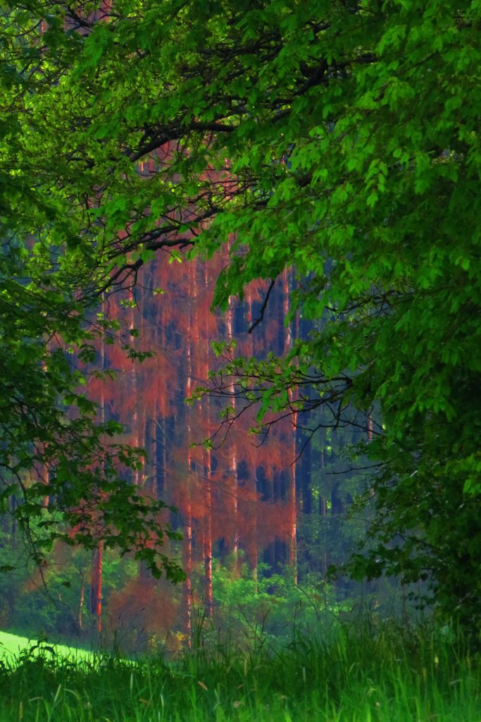
Photo-tip
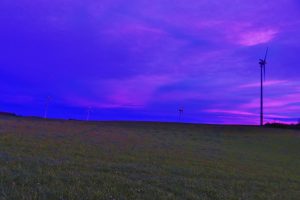
If you are a landscape photographer, stay alert to the changing sunset and sunrise times during the year. Get out for a ride/walk and photo-shoot during the falling dark of the ‘Golden Hour’ – from just before sunset to dark – as often as possible. Dinner can wait! Seek a location with a view of the sky and an interesting scene in the foreground.
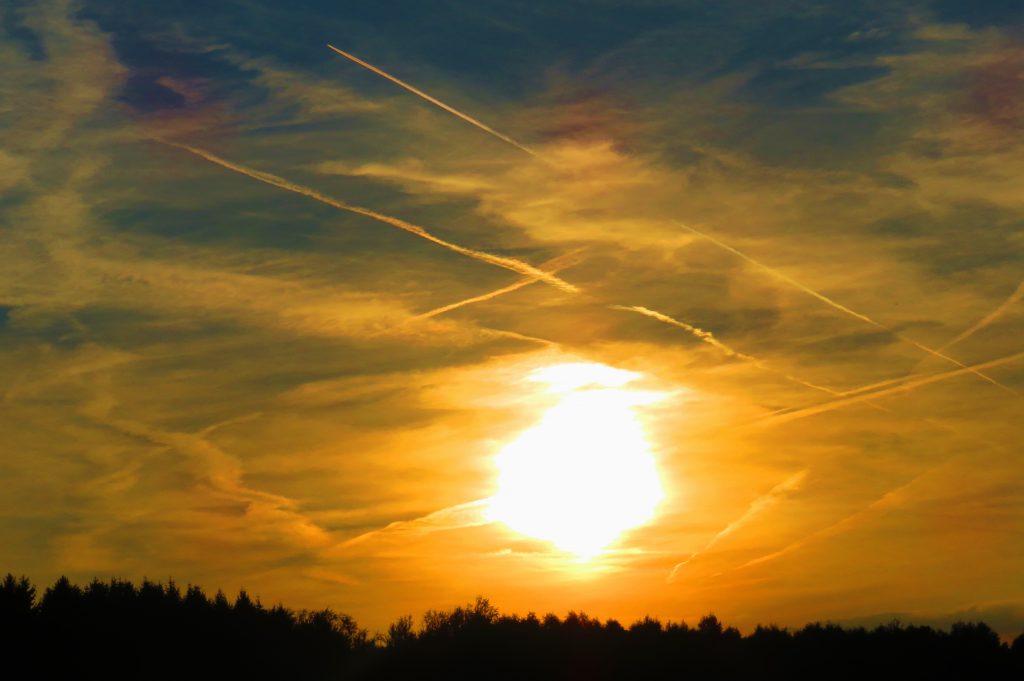
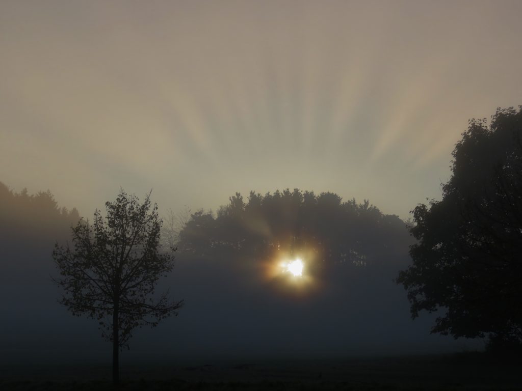
First light to sunrise is the other golden hour. Get to the trailhead before dawn, ready to capture the first light – breakfast can wait! The morning mists, the evening cloud formations, the sunset hues are epic. The windmills are a fine photographic complement to a dramatic sunset – or sunrise – skies above the verdant bergland.
Note About Pronunciation
Since some German and English words are similar, it is easy to forget that pronunciation is quite different in German and English. For example, ‘w’ in German is pronounced as ‘f’. The ‘zw’ in Zwillingbäume features the odd-to-our-ears ‘z’ followed by an ‘f’ sound. So, Zwillingbäume= “SSS-feeling-bom-eh.”
Please comment if you have a chance to walk or ride in the Eschelbacherhof area! Direct comments / suggestions / questions / corrections to this post – or to drmikebowers.guide@gmail.com
And On!
~ DrMike
All photos by Dr. Mike Bowers
© Ideaphoria, LLC
Contact: drmikebowers.guide@gmail.com